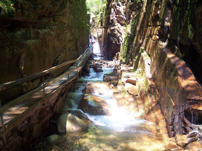
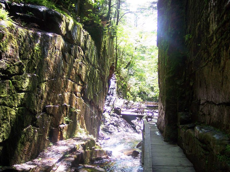
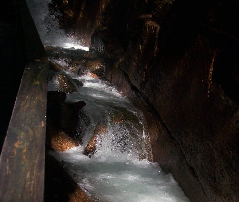
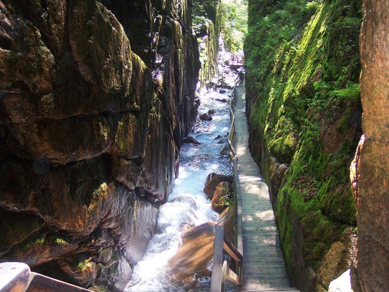
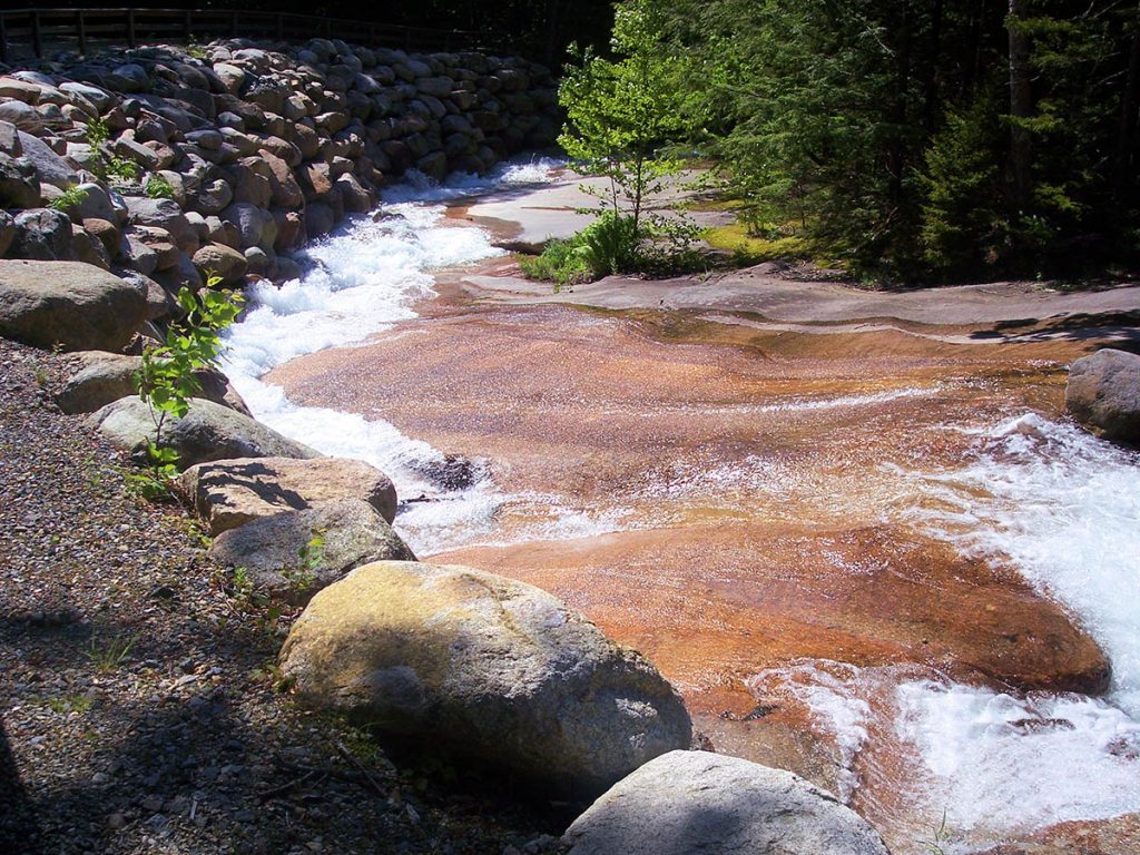
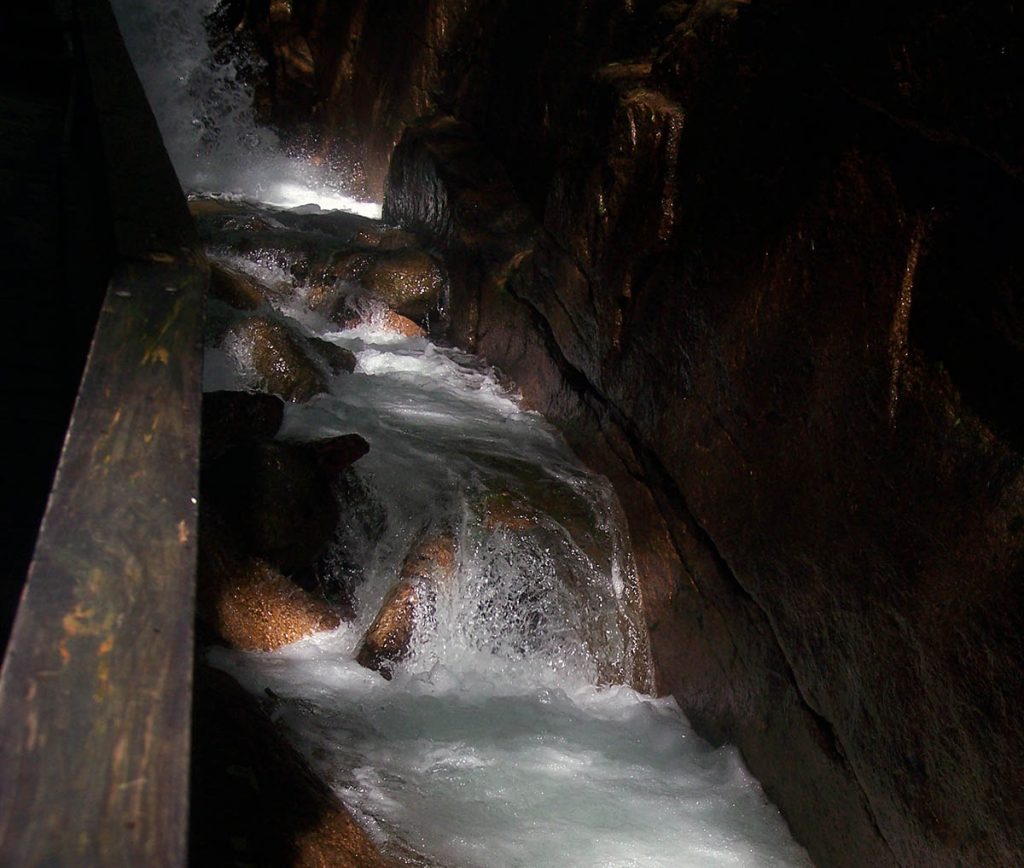
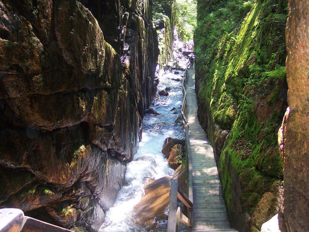
Home  |  NH Webcams  |  NH Events  |  Discussion Forum  |  About Us  |  Contact  |  Advertise With Us  |  Link to Us

 
Highlights:
How to Make Maple Syrup
Family Friendly Ski Areas in NH
NH Ski Reports
NH Snowmobile Trail Conditions
NH Weddings
Live NH Webcams
NH Traffic eAlerts
NH Events
FREE Gas Giveaway!
Lake Winnipesaukee Attractions
NH Lodging:
Most Romantic NH Getaways
Cabins & Cottages
Hotels & Motels
Manchester Airport Hotels
Resorts, Inns, and B&B
Condo/Townhouse Rentals
House Rentals
Camping
Accommodation Tips:
General Travel Tips
Cabin Rental Tips
Condo Rental Tips
Hotel Stay Tips
Vacation Rental Tips
NH Airports:
Manchester Airport
Outdoors NH:
ATV Rentals
Snowmobile Rentals
Snowmobiling
Boating
Hiking Trails
NH Waterfalls
Fall Foliage Report
Kancamagus Highway
Rock Climbing
Environmental
NH Weather
Guided Tours
Skiing
Family:
NH Events
Made in NH
Home & Garden
NH Apple Orchards
Things to do in NH
Weddings
Kids
Restaurants
Other:
Arts & Crafts
NH Airports
Car Rentals & Limos
Farms & Farm Stands
Real Estate Agents
Reports & Reviews:
NH's Top B & B's
Guide to Dining in NH
Recent Trip Reports
Personal Reviews
"Not Quite NH"
Cool NH Stuff:
FREE Gas Giveaway
Haunted Places in NH
Live NH Webcams
NH Videos
NH Photos
Made in NH
NH Made Gifts
NH Themed Products
Fall Foliage Report
Local Events
NH GPS Coordinates
NH Timeshares
NH Webcams:
View All NH Webcams
Balloon Rally Cam!
Bartlett NH Webcam
Dublin NH Webcam
Franconia NH Webcam
Groveton NH Webcam
Hancock NH Observatory
Lake Winnipesaukee Webcam
Lincoln NH Webcam
Lisbon NH Webcam
Mt. Washington Webcam
Ossipee Lake Webcam
Pittsburg NH Webcam
Pittsfield NH Webcam
Portsmouth Harbor NH
Suncook Lake NH
The Ravines NH
Rye Beach NH Webcam
Webcams "Best Of"
Other Webcams:
Mt. St. Helens Webcam
Seasonal Links:
Lake Winnipesaukee
Mt. Washington Auto Road
Motorcycle Week
2010 NHMS Race Schedule
NASCAR Race Checklist
NHMS Track Facts
Fall Foliage Report
NH Snowmobile Trail Conditions
NH Snowmobile Clubs
NH Ski Reports
NH State Parks List
NH ATV Clubs
NH Boat Safety Classes
Florida Snowbird Resources
Interesting NH Links:
NH State Facts
Famous People From NH
NH State Map
NH History

Suncook Valley NH

Unclaimed NH Property
NH Traffic Condition Cams
Services:
Guided Tours
Advertise
Website Design & SEO Services
Other:
Local Links
Other Link Resources
Link to us!
Site Map


The Flume ~ Franconia Notch / Lincoln, NH


The Flume is a natural gorge in Franconia Notch NH extending 800 feet at the base of Mt. Liberty. The walls of granite rise to a height of 70 to 90 feet

and range from 12 to 20 feet apart. The state park is almost 6,700 acres. Every year, hundreds of feet of the Flume pathway (as seen in the photo to the right) is removed due to large amounts of ice build up on the walls of the Flume Gorge. Ice can get 3 to 4 feet thick and rise up to 80 feet high on the walls of the Flume. The pathway is rebuilt every Spring to allow visitors to walk the Flume pathway. The pathway of the Flume is normally reopened by Memorial Day weekend.
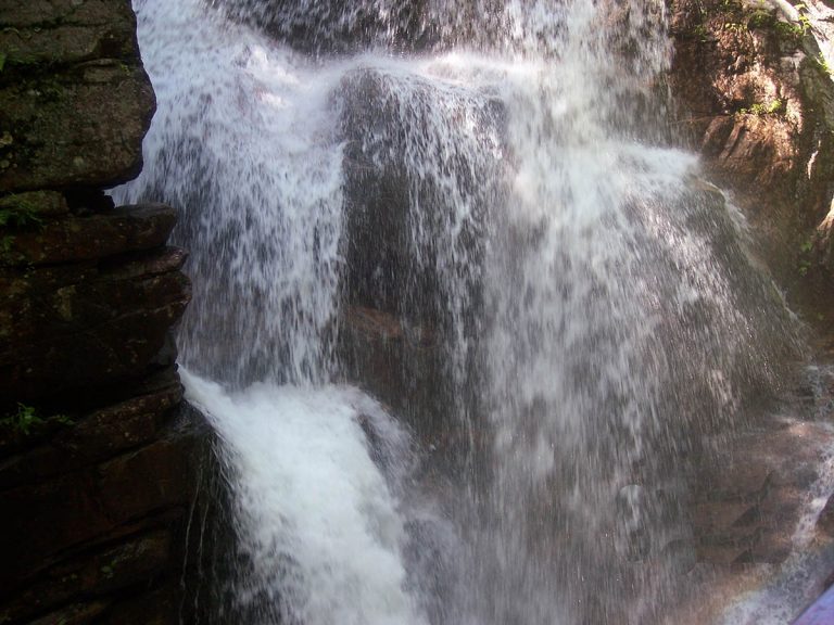
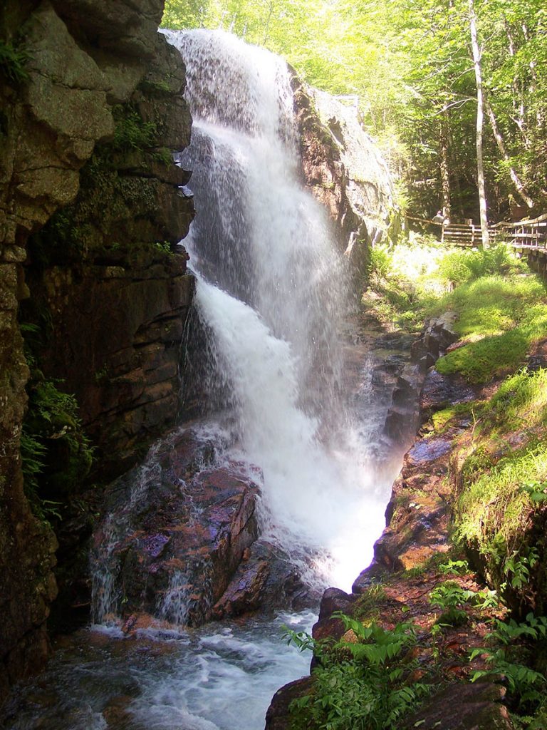
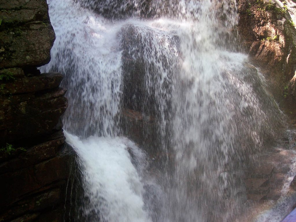
 

Our trip to The Flume in Franconia Notch (Lincoln, NH) was one of 3 visits we made to this state park during 2006 and by far one of our favorite hiking trails in NH. The best times to go there are in late Spring when the winter snow melt contributes to the water in the streams, giving a spectacular view of the waterfalls. Another great time to go is during the Fall Foliage season in New Hampshire. The tree colors are the dry cool days, make it a great experience. It can also make a great refuge from the hot summer heat.


Keep in mind that it can be quite cool and damp when you are in the flume itself. Also, if you are claustrophobic (like me), you may want to prepare yourself for walking up the narrow flume. There are a few places that have tall rock walls, but once through that small part you will be fine.


Every time we have visited The Flume, we have noticed there are a lot of people there from all over the world and usually fairly busy, but don't let the crowded parking lot full of cars and busses scare you away, The Flume is a big place, the trail itself is over a mile long!


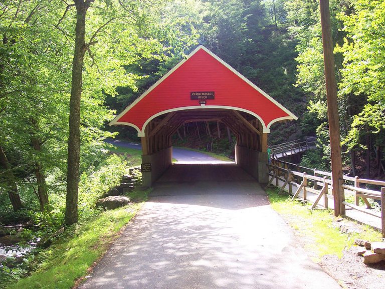
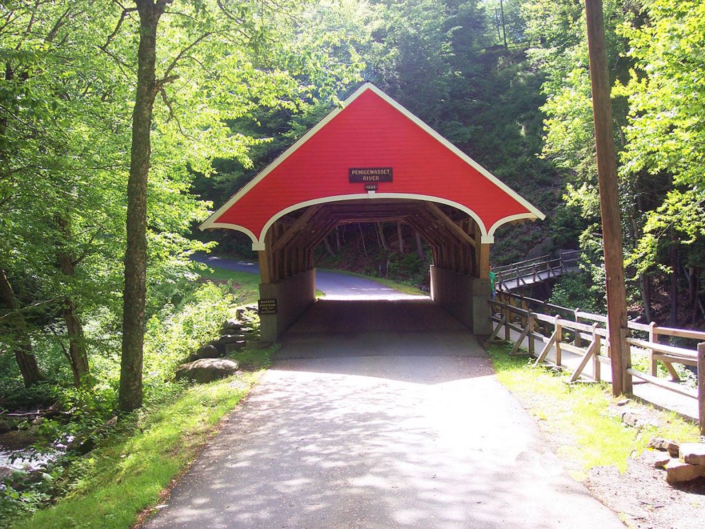
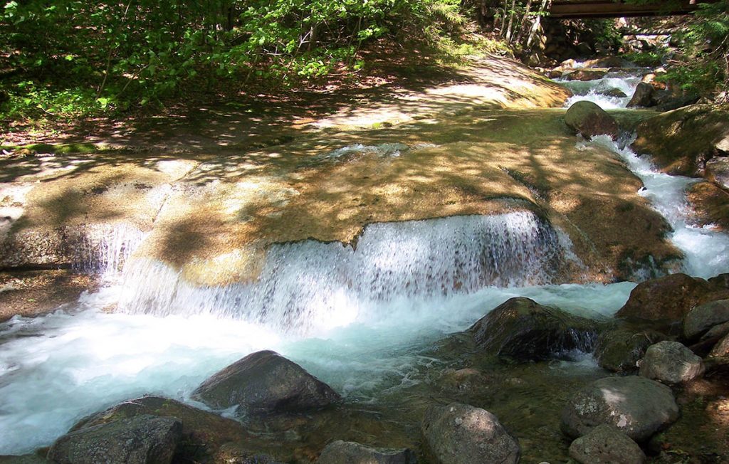
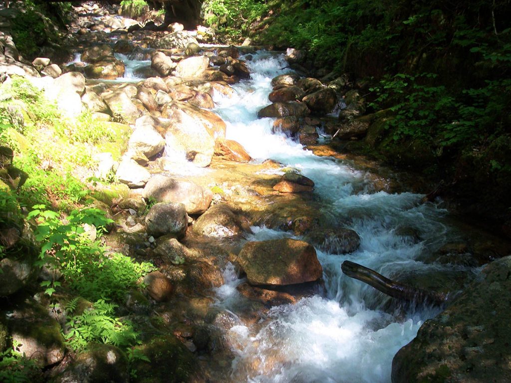
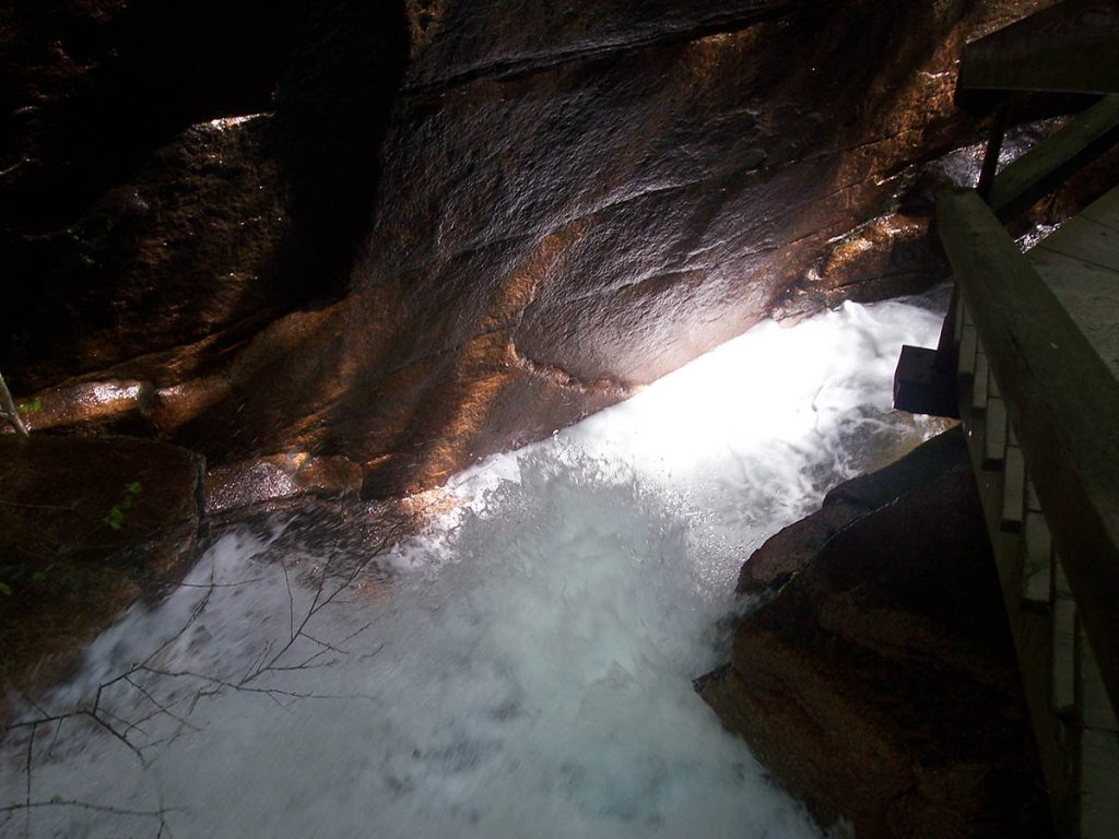
While walking The trail at The Flume, you will go from paved areas, to a covered bridge over the Pemigewasset River wooden pathways, to dirt trails. During your hike on The Flume trail, and after you go through The Flume itself, you will see 2 trails that are on your left. The trails offer a view of "The Pool." Many people walk right past these 2 trails, but in fact offer some of the most breath taking views The Flume has to offer (see picture of the pool on your left-view looking straight down from the observation deck)! So be sure you don't just walk by these 2 trails (unless you are afraid of heights!). Shortly after this part of the trail, you will come across another covered bridge, but don't just walk over the bridge without reading the plaque. The bridge was built on top of a fallen tree in 1939. The tree fell during a storm. After you cross the bridge, be sure to walk up the hill and look back at the bridge, under it, you will see the tree trunk! Also, immediately after the bridge is a cave. The "Wolf's Den." Which is a rock cave just big enough to squeeze through (better for kids than adults).


From this point, the trail soon completes a circle and brings you back to the visitor center near the parking lot.


The Flume Gorge & Visitor Center is open early May to Late October

Location:

On I-93/Route 3, Franconia Notch Parkway, Lincoln/Franconia

The Flume Parking Area GPS Coordinates: N44° 05.814' | W071° 40.945'


Phone: General Information:603-823-8800
Flume Gorge & Visitor Center :603-745-8391

Area Activities: Camping, swimming, hiking, picnicking, fishing, boating, biking, skiing/snowboarding, cross country skiing, snowmobiling


Area Amenities: Campground, RV campground, restrooms, cafeterias, gift shops, 8-mile paved recreation path, canoe, paddle boat and bike rentals, boat launch, covered bridges, hiker information center, New England Ski Museum, full service ski area


Phone Numbers for Area Attractions:

Lafayette Campground: 603-823-9513
Cannon Mountain, Echo Lake Beach, Cannon RV Park:
603-823-8800


Lafayette Place Campground GPS Location

N44° 08.554' | W071° 41.014'

Click Here to View the Photo Gallery of This Trip!

Fast Facts About This Trip:
The Good:
  • Great way to spend the day with kids and get some exercise at the same time
The Bad:
  • N/A
The Ugly:
  • If you are Claustrophobic, or have a fear of heights, be prepared for a few bad spots.
Tips to Remember:
  • Bring water bottles for everyone. You can refill them in the streams if you wish.
  • Pack a lunch
  • There is a small fee to get in that helps contribute to the maintenance of the park
  • Don't forget your camera!

View Our: List of NH Waterfalls!


Date of Report: June 12, 2006


Home  |  About Us  |  Contact  |  Advertise With Us  |  Link to Us  |  Site Map

Copyright © 2007-2010. NH Tour Guide.com. All Rights Reserved.