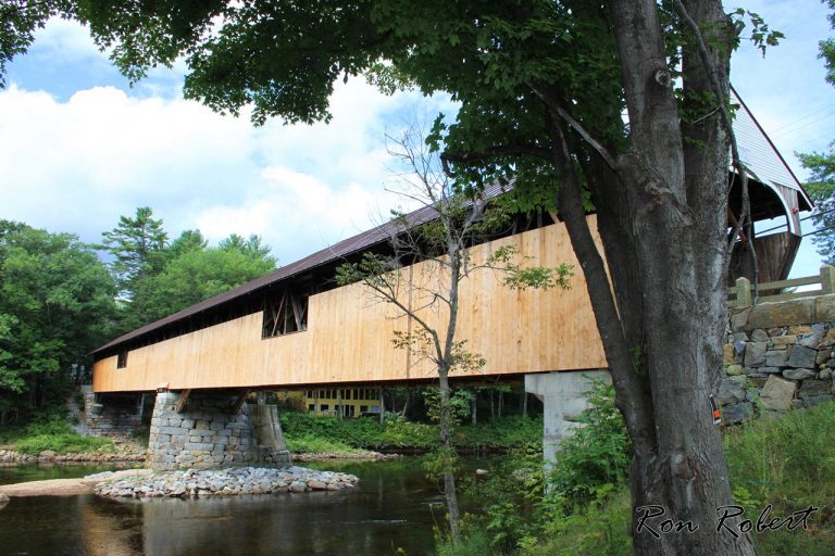
blair covered bridge
Attractions 48
Beaches 4
Biking 6
Boating 18
Businesses 16
Camping 104
Fairs 3
Festival 1
Fishing 8
Foliage 7
Guided Tours 37
History 17
Legends 14
Museums 7
Not Quite NH 12
Oddities 8
Photo Worthy 28
Photos 10
Picnic Spots 17
Recipes 4
Restaurants 10
Shopping 10
State Parks 11
Things to do 93
Videos 1
Waterfalls 59
Weather 3
Webcams 23
Weddings 41
Wildlife 1
Sorting Options
Favorite
Blair covered bridge is located on Blair Rd in Campton, NH. Blair bridge can be accessed from exit 27 on I-93, go East at the end of the ramp on Blair Rd. Blair covered bridge can also be accessed from Daniel Webster Highway (Rt. 3), also heading East at the Blair Rd intersection in Campton, NH. Located next to the Read more...

Livermore Falls
Favorite
Livermore Falls, Campton NH Livermore Falls in Campton New Hampshire is a waterfall on the Pemigewasset River with a 25′ total waterfall drop. Livermore Falls is on the Plymouth NH town line but is indeed in Campton NH. Check the old photo below incorrectly depicting Livermore Falls as being in Plymouth NH. Livermore Falls Directions: Take exit 27 on I-93 Read more...
